


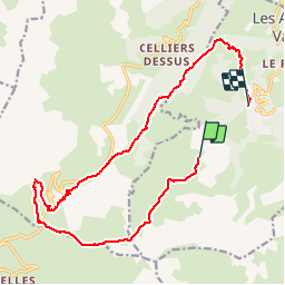
20160725 Valmorel - Col de la Madeleine

xtof_ts
User

Length
17.8 km

Max alt
2177 m

Uphill gradient
456 m
Km-Effort
26 km

Min alt
1345 m

Downhill gradient
1011 m
Boucle
No
Creation date :
2016-08-19 00:00:00.0
Updated on :
2016-08-19 00:00:00.0
5h10
Difficulty : Medium

FREE GPS app for hiking
 SityTrail
IGN / Geographical institutes
SityTrail Plus
The world is yours!
About
Trail Walking of 17.8 km to be discovered at Auvergne-Rhône-Alpes, Savoy, Les Avanchers-Valmorel. This trail is proposed by xtof_ts.
Description
Utiliser l'Altispace pour le départ.
Positioning
Country:
France
Region :
Auvergne-Rhône-Alpes
Department/Province :
Savoy
Municipality :
Les Avanchers-Valmorel
Location:
Unknown
Start:(Dec)
Start:(UTM)
298590 ; 5036127 (32T) N.
Comments